Gran Canaria with its snow peak
The Palmas de Gran Canaria is the main city of Gran Canaria, a Spanish island located very close to Tenerife, another Spanish island and near to the coast of Sahara and Marocco. I went there just for a weekend of September, visiting the city, some villages and going to the higher mountain of the island, the snow peak (pico de las nieves). The city itself has nothing "interesting" offering some typical cultural things like the castle which is now an art museum/foundation of Martin Chirino with its small park, the science museum, the aquarium (scheduled to open end 2017 or 2018). Most of people come here for the beach and the surf. |
|
The hotel NH Imperial Playa (calle ferreras 1) is located just next to the beach, unfortunately, I didn't get a room with a view to the sea, I didn't want to spend too much money because there is an extra cost for it. Anyway, the goal is to have a good room with a good bed for a good sleep, and I got it.
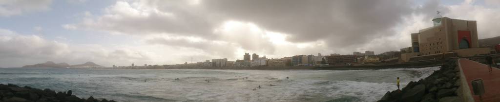
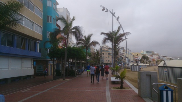
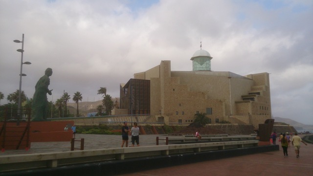
The weather was very cloudy but still hot because of the high humidity, at least, it was not raining. There is a very long walking pedestrian street running along the beach, I did it between the Alfredo Kraus auditorium and the alonso ojeda square (some people kept going on because it brings until the beach of the Isleta called confital). There is also a walk street along the harbor side (the other side of the beach) which is very very long, until the palo square with Triton, a statue paying tribute to the sea god.
In the top of the Isleta area, there is a lighthouse and it seems one of good spots for the sunset if you want to shot with the city. Since I went to the degollada becerra viewpoint, not far away from the snow peak viewpoint, I can't guarantee it.
 |
 |
I rented a car with the Lencar company (calle gran canaria 2) for 27 euros per day a "ford ka" (a small car) without GPS, the office is just at 3 minutes walk from the hotel so very practical. I asked the guy some recommendations telling him that I will go to the higher mountain of the island and he told me some villages that I had to stop.
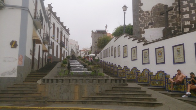
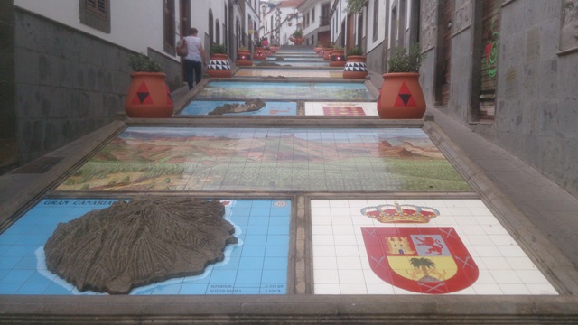
So my first stop was the Firgas village. In fact, the renting guy told me to stop first at Arucas, for its famous black church but I am not very fan of that so just seeing meanwhile driving, it was enough. The only interesting thing in Firgas is to discover the canarias passage, a series of stairs with a nice fountain and 8 mosaics describing the island. People can take a break in the nice garden of the church and take a panorama picture to the sea.
 |
 |
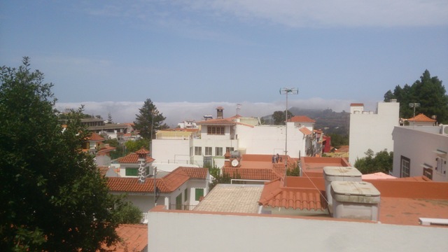
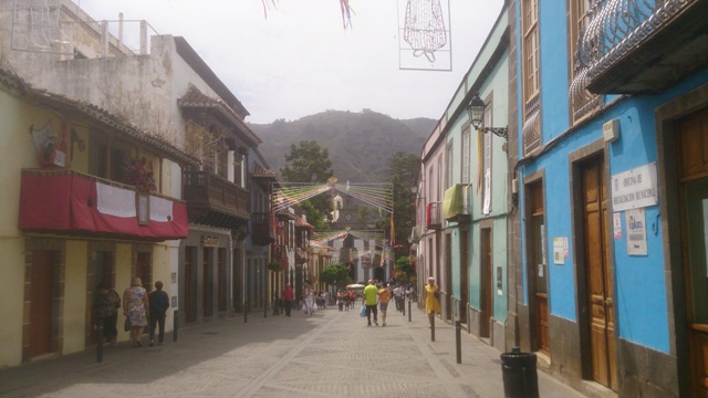
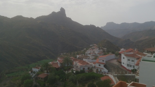
My next stop was Teror, yes as it sounds so very scary!!! Well, in the contrary, it is a nice village which was celebrating the 250th anniversary of its basilica built in 1767 when I visited it so the main streets were quite busy. Next, Artenara, located up to the mountain, the sky was sunny and the clouds were below. In fact, at Valleseco, the next village after Teror, I already crossed the clouds, and going to the main square, I could see it clearly the split between the good and the bad weather but not only that, the difference of temperature was significant too.
 |
 |
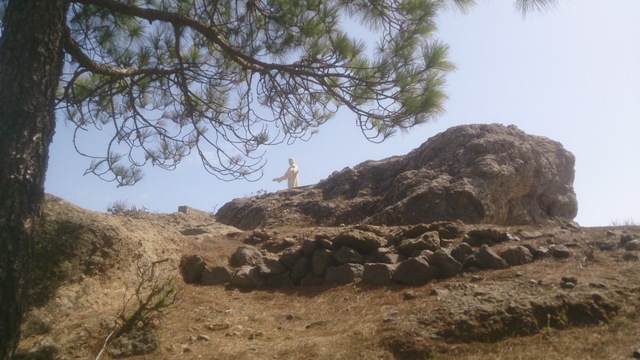
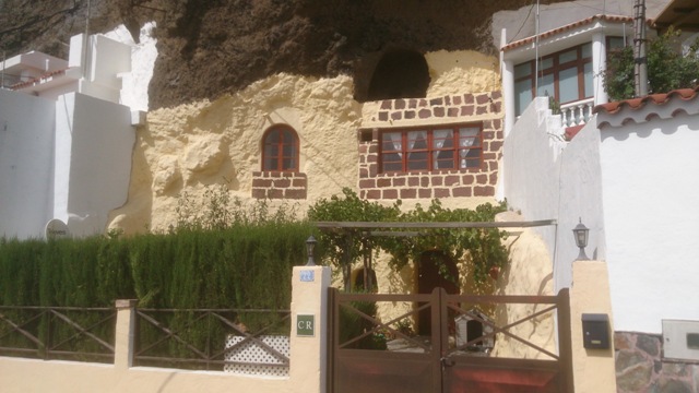
Artenara is famous for its grotto houses, houses built directly into the mountain. Overlooking the village, there is a status of Jesus, to enjoy a 360 degrees panoramic view, I took the small track located just at the entrance of the road leading to a private house. It is not easy to find, go to the Cilla restaurant and keep walking, at few steps, you will see the entrance on your left, and just passing it a little, the track.
 |
 |
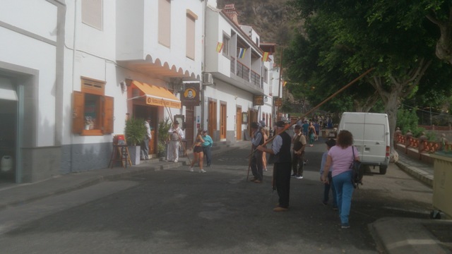
Keeping driving up to Tejeda, the village was celebrating its local festival, it was nice to see because people were dressing as in the past. Now my next stop was the highest point of the island, the snow peak or as local called it, pico de las nieves.
So far, I have to say that driving in Gran Canaria is quite nice because the roads are well built and a lot of indication panels, even without a GPS, it is easy to find the places. In every crossroad, there is a panel so it is really appreciable but in some way, from Tejeda, there is no panel for the snow peak, I went first to Cruz de Tejeda and from there, there is the panel showing me the way up (the road going down is to go back to the city that I took to return to my hotel). It was here that I made really my first break (I didn't stop to lunch), I was driving from 12h30 until 17h30 making a stop of 15-20 minutes per villages. My goal was the sunset so I had plenty of time since at this period, the sun would start to go down around 20h.
 |
 |
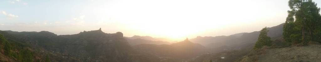
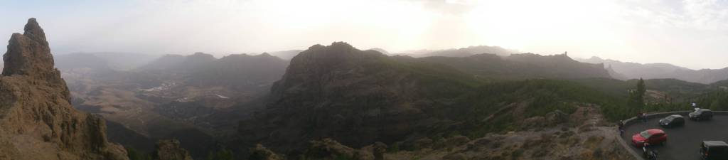
So around 19h I reached the famous place, the bad point was that the clouds surrounded the island so no way to see the Teide, the famous mountain of the Tenerife island and of course, I didn't watch a lovely sunset with all its orange and red colors. Anyway, I decided that I would see the sun going down until the clouds but I did it from the degollada becerra viewpoint.
It is located few meters down the pico de las nieves (you can’t miss it because it is on your way). I found that the view is much beautiful, and taking the small track going up a little, I arrived into an area where I saw the 3 famous volcanic rocks (from left to right): friar (fraile, looking like an old man), clouded and frog (nublo y rana) and bentayga, better than the other place. From here, it is also possible to see the Teide if the sky is blue. Around 21h, the sun was behind the black clouds showing no colors so time to go back to the hotel.
The way back was quicker since I didn't do any stop. If you are driving like me, the road is lighted, there are few sections with no light, I mean totally in the dark. And the second point, when you will reach the highway, you will see a panel "centro de ciudad" (downtown), at the beginning it confused me because it doesn't put "palmas gran canaria centro ciudad", I decided to take it because the other highway panel doesn’t show the direction of the city so I just kept following the "centro ciudad" panel. If you have a GPS, it will be easier.